We'd sit and talk of Hollywood
And the good things there for hire
And the Astrodome, and the first teepee
Marlon Brando, Pocahontas, and me
—Neil Young
You never quite know what’s coming with Type 1 diabetes. And whatever comes, it might not last that long.
Having had T1D since I was nine, I’m used to it. (Sorta.) So that made the wildness of today’s drive from Los Angeles through the San Bernardino Mountains a little less confounding than it might otherwise have been: the dramatic and astonishing beauty of the landscape kept shifting into something different and unexpected, and just like with blood sugar, all I could do was roll with it and keep paying attention.
It’s only Day 5 of this long road trip and it seems like two months’ worth of things have come my and Masayo’s way already. Just in the last 24 hours we went from the Hollywood sign in Los Angeles to a motel made of wigwams to crystal blue alpine lakes under snow-capped mountains to wind-swept desert rock and scrub brush. And we didn’t even drive that far.
California changes faster than an impertinent dose of Humalog!
The Hollywood sign: Is that it?
As we left Los Angeles after visiting family we found ourselves driving on Mulholland Drive, from where you can get a glimpse of the hillside Hollywood sign. We had vague directions of where to go (“go a couple miles and look for a turnoff”) and soon found ourselves, as the evening sun began to lower over the Pacific, up in a hilltop series of dusty trails between yellow blooms called Runyon Canyon Park.
![]()
We weren’t sure if it was the right place but the parking lot was full, people were sallying forth in yoga pants or with dogs and leashes, so we set out ourselves. As we came around a bend on the trail, a jogger panting and wheezing beside the trail, there it was: big white HOLLYWOOD letters on a distant hillside under a tall communications tower. (To be honest, it was the tower that dominated the view, not the letters so much, which were at an angle and barely legible.)
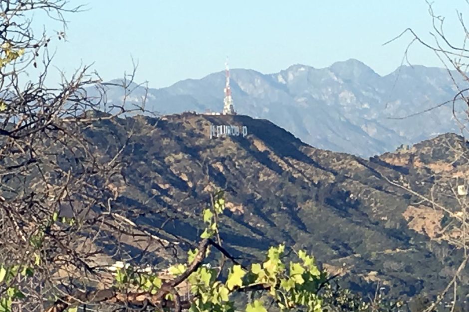
The best my iPhone could do at such a distance. See HOLLYWOOD under the tower?
We hiked to the end where others were gathered, gazing far out over Los Angeles and getting warmed by the warm sun in the slightly chilly air. A couple guys walked past us chatting and one was smoking a joint like it was nothing.
I suddenly recalled that California has just legalized recreational marijuana, and so it really was nothing for this guy. That’s part of the fun of leaving the US for a long time and then coming back and marking the changes.
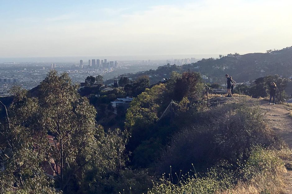
Looking down on Los Angeles and the Pacific Ocean.
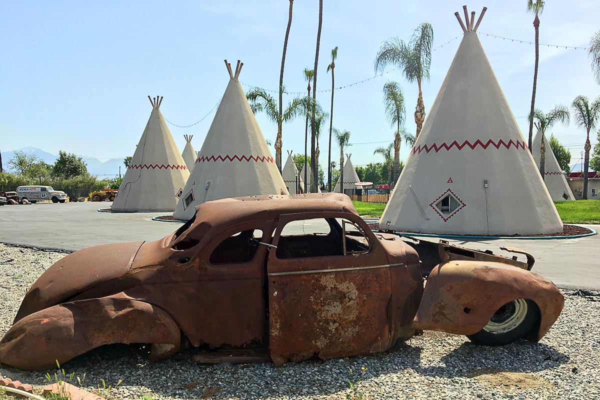
Wigwam Motel (or are they teepees)
After a drive down highways into San Bernardino, enlivened significantly by the gorgeous sunset in the rearview mirror and the gigantic round moon stuck to the sky over the hills in front of us, we pulled into the Wigwam Motel, where I’d made a single-night reservation on booking.com. It was after dark but impossible to miss: large white wigwams, about fifteen of them, scattered around a semicircle. They had poles sticking out of the top, red zigzag lines across them, and curtain-looking door flaps. (All decorational, not functional.)
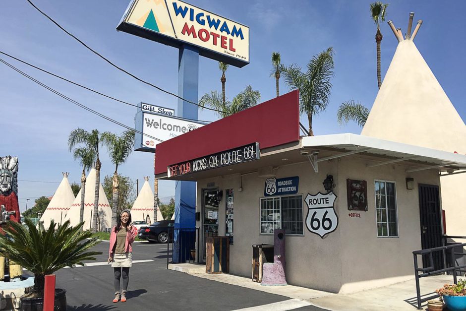
Masayo at the Wigwam.
We checked in; the host, Kumar, seemed tired but super-friendly. There was no breakfast, but he’d be coffee in the morning, he said. And so off we went to Wigwam #14 – with our own reserved parking space! – and for the first time entered a Native American wigwam. Kinda.
(As it turns out, the Wigwam Motel, long a tourist attraction on famed Route 66, had been misnamed from the start: a wigwam is actually a dome-shaped structure. It’s teepees (or tipis) that are the tent-like contraptions shaped like cones with poles coming out of the top. As a further side note, wigwams are also called wickiups which would be the best name of all.)
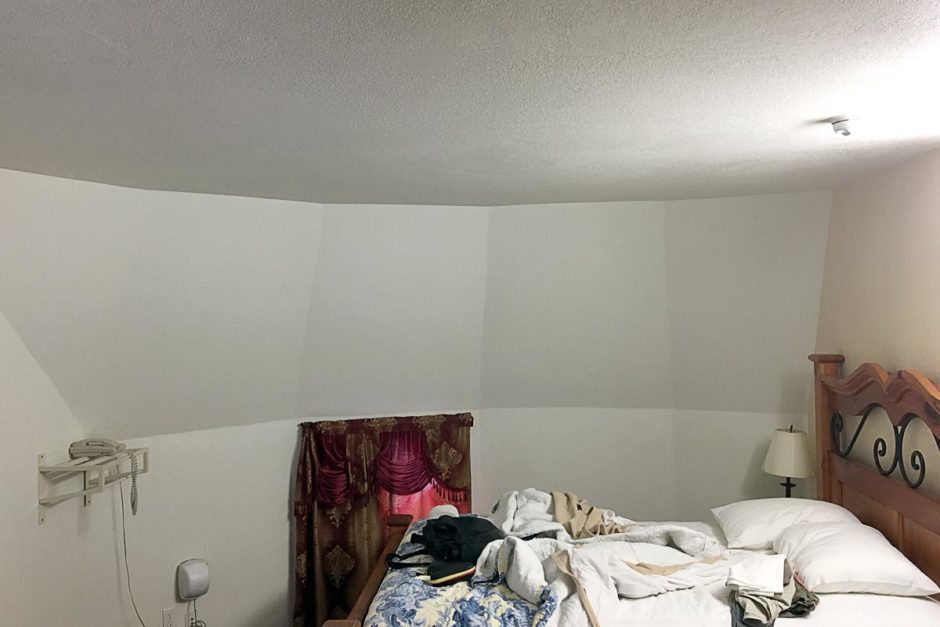
Inside, the room was in fact very modern: the power adapters even had USB plugs in them. Even the Quality Inn in Thousand Oaks didn’t have that. The walls were sloped in, naturally, but a ceiling prevented us from seeing up to the top point. There was a TV, nice shower and bathroom, big bed, and a sofa. I liked it immediately, and we soon found ourselves eating Burger King and watching My Cousin Vinny on HBO.
The night in the Wigwam passed by pleasantly. Occasionally, cars drove by noisily on Historic Route 66 outside. Normally this annoys me but each time one roared past I got a mental picture from the driver’s perspective of these white cone rooms here in the flatlands of San Bernardino and got a warm, cozy feeling. Sometimes traffic noise can be soothing.
San Bernardino Mountains: A world away
Instead of taking I-10 towards Joshua Tree National Park the next day (a route which passes by the big dinosaur statues featured in Pee Wee’s Big Adventure) we opted for a circuitous route through the San Bernardino Mountains.
Up Highway 330 we drove, into steep and dramatic mountainsides covered in dark-green trees. Masayo pointed out some white patches on surrounding hillsides, remarking that they looked like snow. We laughed dismissively before realizing it really was snow. And it wasn’t even that cold outside; I had on short sleeves and the window rolled down as the car wound slowly around hairpin curves on a well-maintained, high-quality asphalt road. It was chilly, but not cold.
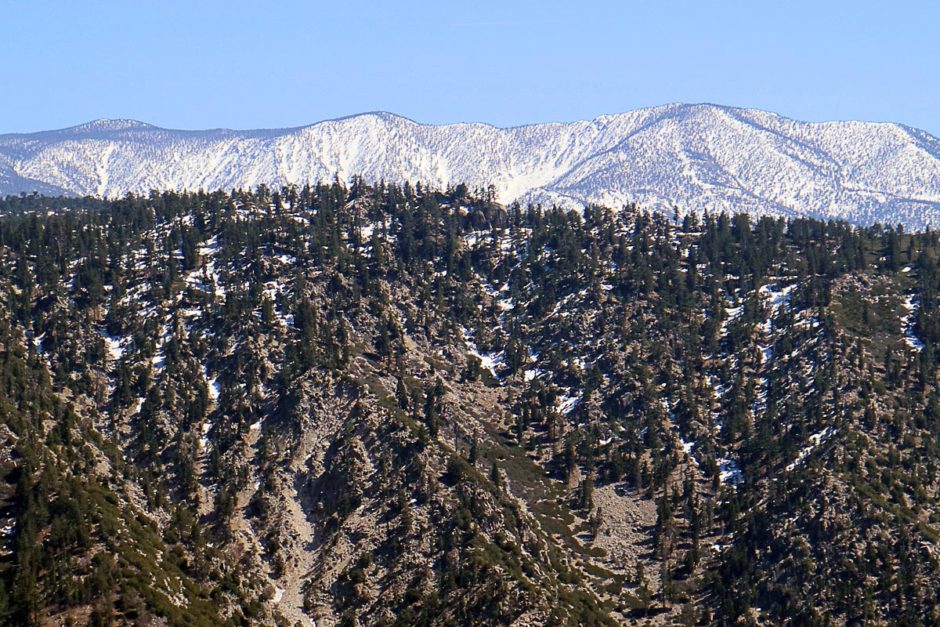
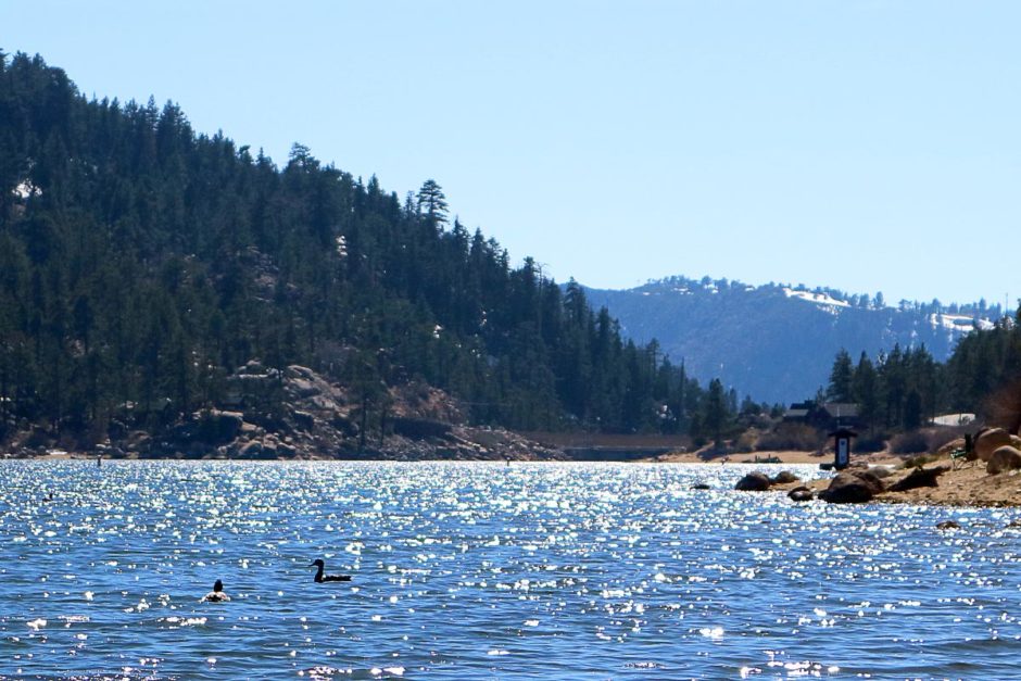
Eventually we found a picnic spot next to Big Bear Lake, and as we sat on large tan rocks (Masayo now wearing an extra sweater) and watched ducks swim through the sun-sparkled waters, we munched on turkey sandwiches and gazed at the far shoreline and the snow-peaked mountains behind it.
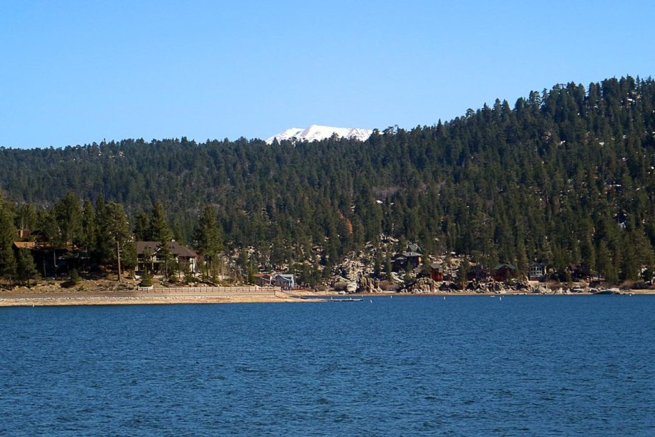
Were we just down in the flatlands like an hour ago? It seemed like we were suddenly in Colorado. But no, this was still California.
How the other half lives: in the dusty desert
After our repast we continued along the shore of the lake and after a few minutes the landscape changed, imperceptibly but utterly. Just like that, the snow and green trees and shimmering blue lakes were gone and everything was tan: the boulders, the sandy rock hills all around us, even the sun off-handedly heating up the road surface.
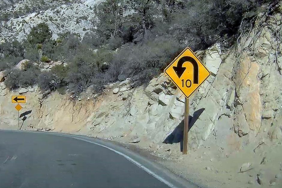
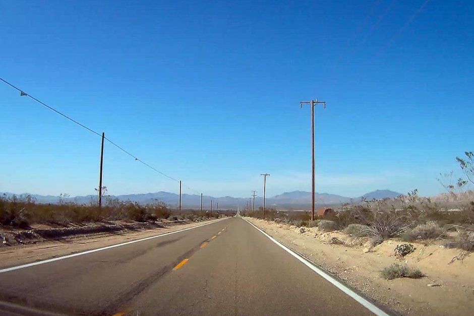
The only thing the same was the winding road and frequent signs warning of 10 MPH curves ahead, but those too soon disappeared and we found ourselves on a long, flat, straight road surrounded by low bushes and scrub brush on vast sandy fields.
Way ahead of us in the distance was a long row of tough-looking red rock mountains, with a distinctive lack of green. Wait, weren’t we just having lunch beside an alpine lake like an hour ago? It wouldn’t seem so, judging by this unexpected landscape.
That night Masayo and I thought back upon the past 24 hours. The Hollywood sign already somehow seemed like weeks ago, but it wasn’t. And after driving through the desert along Old Woman Springs Road for a couple of hours it seemed like Big Bear Lake too was a distant memory.
This trip is throwing a lot at us, fast, and the crazy landscape of southern California has been an unexpected and motley jumble of experiences. As blood sugars go up and down and around (often when you least expect) so do the highways in this part of America.
The only way forward is to go with the flow, learn from your experiences, and keep moving around. And, whether traveling, tending to diabetes, or both, stay inquisitive. What’s your blood sugar? Check it and see! What’s around the next bend? Only one way to find out – go!
See some, miss some
One of the guiding principles of this road trip is no interstates. But that’s not really all that workable in some parts. We had the choice of taking I-10 from San Bernardino to the entrance of Joshua Tree National Park, but lucky for us there was a longer, slower, and much more interesting route through the mountains.
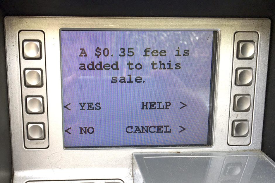
“Can we take more money from you for unspecified reasons?” What could I do? I hit “yes”.
Up Highway 330 into the mountains we went, joining up with Highway 12 which winds through the wintry trees to Big Bear Lake. Here we veered off onto Highway 38, a short Scenic Route that follows the north shore of the lake. We joined back with Highway 18 which took us down into the desert valley and then found Highway 247, a long and flat road through the arid desert landscape towards the town of Yucca Valley and Joshua Tree National Park.
So we may have unfortunately missed the Pee Wee’s Big Adventure dinosaurs, which are along one side of I-10 near San Bernardino, but so be it. This trip is going to be generating a longer and longer list of “missed” things, like all trips do. You can’t see everything; all you can do is gas up and go and enjoy what you do see.
Good news is breaking through
I’ve had too many high blood sugars too consistently on this young trip so far. But in a big change from my European odyssey of a couple years ago, there are frequent and encouraging signs this time that I am handling it better and fixing it more quickly.
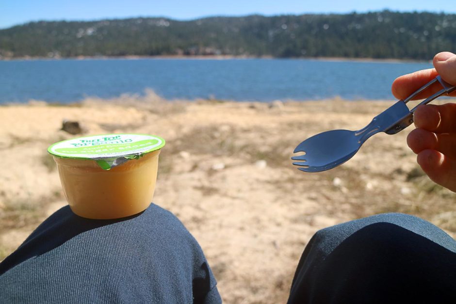
Applesauce with a spork – if this looks fun to you, you’re my kind of person.
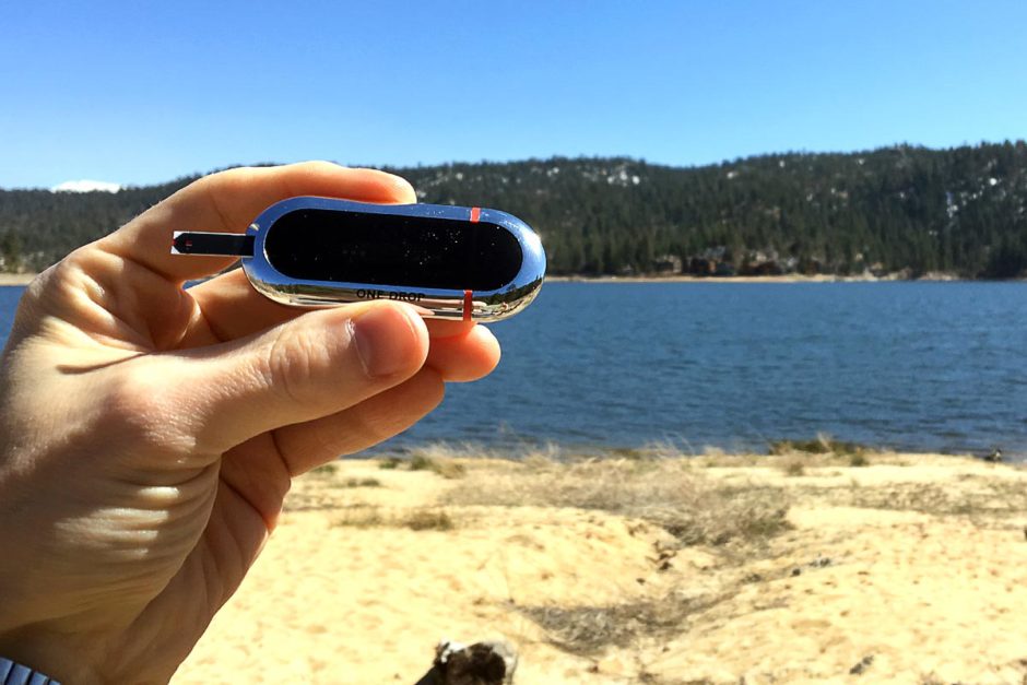
Still working on getting legible photos of the One Drop meter outside.
While my BGs on Day 4, going from the Hollywood sign to Wigwam Motel, were atrocious – the best was 199. But on Day 5 I was able to bring that down a couple of times: before the picnic at Big Bear Lake I was 81, and proudly took a photo of my One Drop meter in the scintillating surroundings.
However, despite checking the nutrition info and dosing Humalog carefully, I must have had too much Chex Mix or Fig Newtons or something; I was 212 before dinner. But right before bed I was a mere 51 – not cool, but not high.
The best sign of all is that even when I’m high, it’s not super-high. Usually below 220. That’s definitely something I can work with as I adjust to eating American food again and overcome the final vestiges of jet lag after flying from Japan to L.A., which is gone from daily life now but which might still be exerting some chaotic influences over my diabetes.
Thanks for reading. Suggested:
- Share:
- Read: Day 6: Sun, moon, and cacti: Joshua Tree National Park
- Join: Free email newsletter (info and early video access)
- Support: Patreon (much earlier video access and other perks)
Support independent travel content
You can support my work via Patreon. Get early links to new videos, shout-outs in my videos, and other perks for as little as $1/month.
Your support helps me make more videos and bring you travels from interesting and lesser-known places. Join us! See details, perks, and support tiers at patreon.com/t1dwanderer. Thanks!
Want more? Get the free newsletter
Join us! Sign up to my email newsletter to receive updates, behind-the-scenes info,
and early links to my new YouTube videos before everyone else