There'll be wind in the canyon
Moon on the rise
As long as we can sail away
—Neil Young
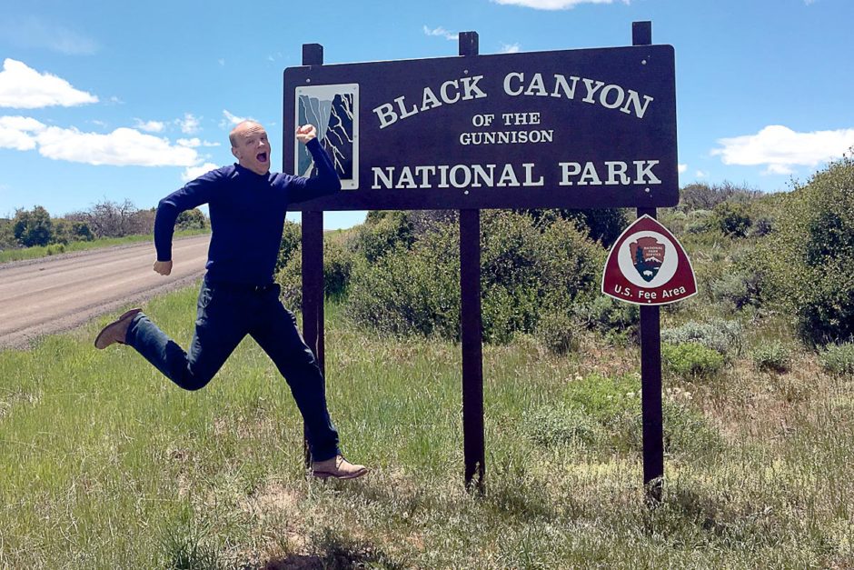
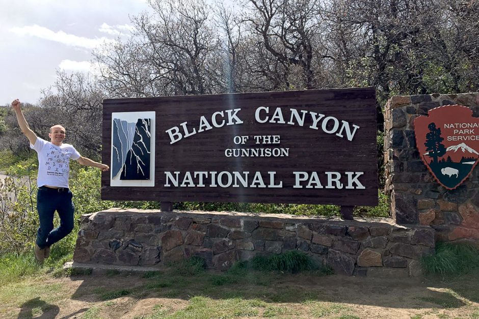
Some National Parks are good for hiking, some for driving, many for either (or both). And sometimes, on a lengthy road trip where you’re skipping around to as many Parks as you can, your mood matches the next Park you find yourself in. At Black Canyon of the Gunnison National Park, Masayo and I took our time and saw the place correctly. Best of all, we weren’t in the mood for any hiking, and hiking the Black Canyon is such an undertaking that few dare try. You need a permit even for a day hike; it’s a fearsome trek.
Still haunted by the feeling that we hadn’t seen enough of Great Sand Dunes National Park, and having had to skip Rocky Mountain National Park at the last minute due to snow-induced road closures, I was determined to get what I could out of Black Canyon of the Gunnison.
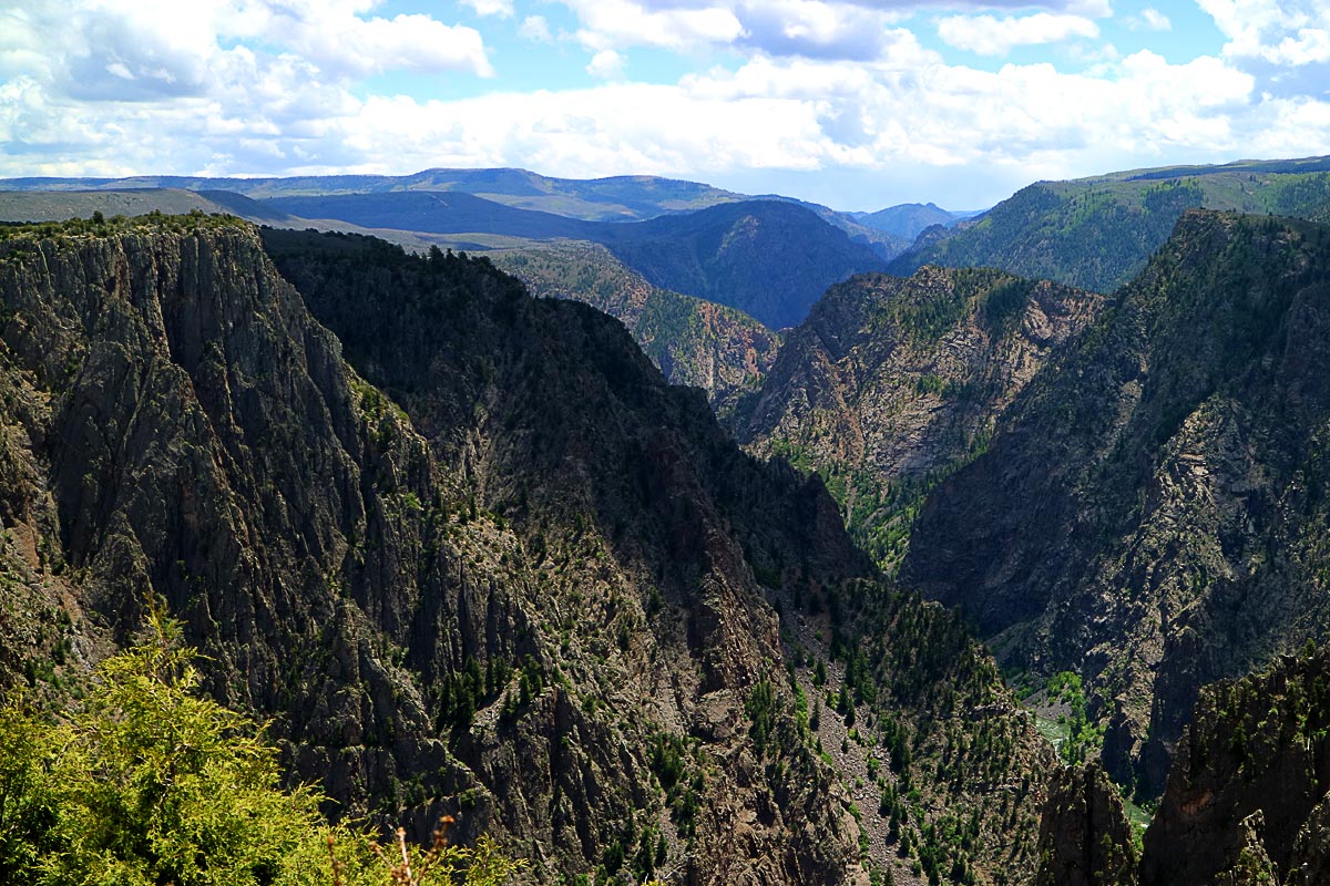
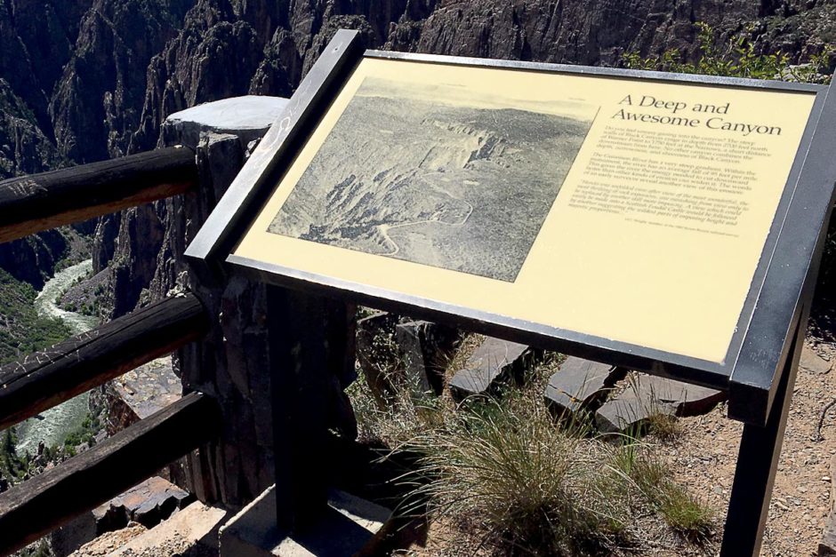
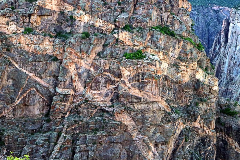
The Gunnison River winds through this part of Colorado and loses a lot of elevation in a very short distance. This means that the waters of the Gunnison cut through the rock more forcefully than most other canyons in the world. So instead of slowly carving out intricate shapes and creating wonderful formations, like the Grand Canyon, the Gunnison just plunged downward and left behind a canyon of sheer, nearly vertical walls. The north wall, especially, is so steep that daylight only gets in for a small part of the day – the rest of the time it’s in shadows. Hence the canyon’s name.
My new favorite photograph.
You can visit the north rim of the canyon and the south rim; both have drives that skirt along the rim with occasional pull-outs and viewing areas. It can all be done by car; no undue hiking necessary.
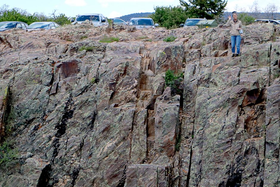
Very few visitors make it to the north rim of the Black Canyon; the visitor center and larger towns are near the south rim and that’s the Park’s main street. So of course, we decided to buck the trend and visit both, but the north rim first.
The north rim
It was a nice, sunny afternoon when we arrived at the north rim and there were indeed very few other tourists there. The entire drive is only about seven miles; it’s a relaxing and obviously scenic drive.
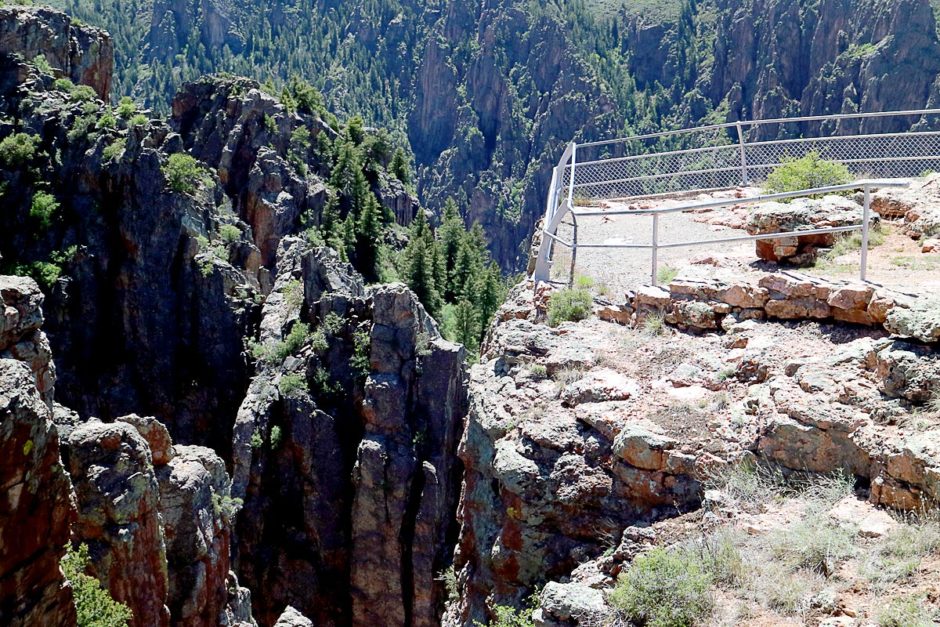
We stopped at each pull-out, racing down the short paths to the precarious viewing areas perched at the very edge of the deep canyon. In either direction the angular rock walls extended in haphazard directions, and far, far below, the Gunnison River pounded through its fierce and narrow channel. We could hear its low, distant roar, and that was saying something: it must be noisy if we could hear it from up here.
It was also very windy, making photos difficult to concentrate on and the rickety-looking railing all the more scary. The north rim sees less sunlight throughout the year and so there is less melting snow after winter; its walls are the steepest of the canyon whereas the south rim does have a more gradual grade and has more green growth on it.
From the north rim you can very easily see the south rim; there are no bridges across the canyon but the Gunnison carved its way so steep that it’s easy to make out cars and people on the other side.
The north rim of Black Canyon of the Gunnison was dramatic, with exhilarating views and a welcome lack of people.
The south rim
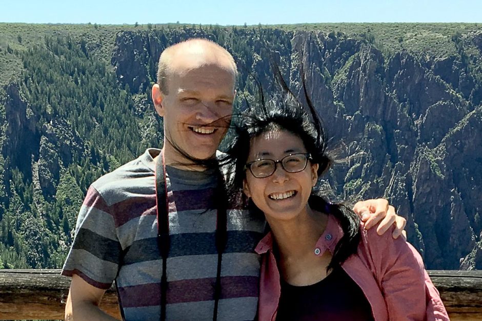
We drove all the way around (a couple of hours) to the town of Montrose near the south rim for the night, and the next day woke up and drove to the Black Canyon’s mainstream tourist area.
After a stop at the visitor center we had two objectives for the day: the two roads that extend through the park. There’s the south rim drive, similar to the north rim, and then there is the infamous East Portal Road that leads down, to the river itself.
Dooooooown East Portal Road
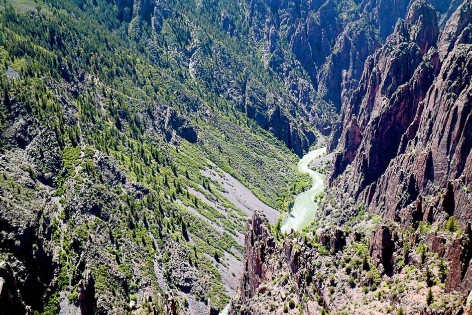
East Portal Road is known for its grade: at 16%, you need good brakes and a low gear to descend quickly to the banks of the Gunnison. Having glimpsed the green frothy river from the north rim yesterday, I knew it was a long way down. And I knew my trusty car could handle it.
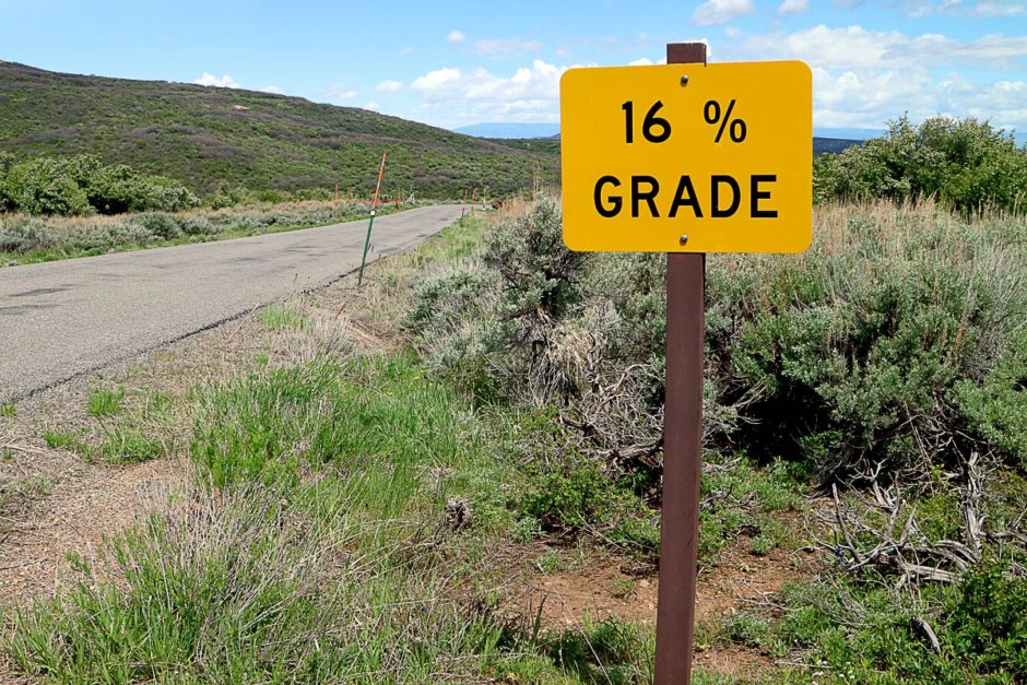
The grade was indeed steep but what I hadn’t anticipated was the astonishing loveliness of the descent. It was a compelling mixture of soft greens, harsh dark rocks, and curious folds through which this tiny little road twisted and jerked on its way down below. Around each curve a new view opened up.
And the Gunnison River kept getting bigger and bigger.
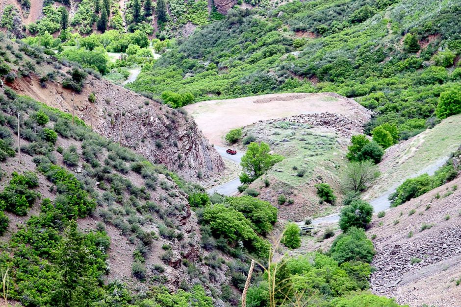
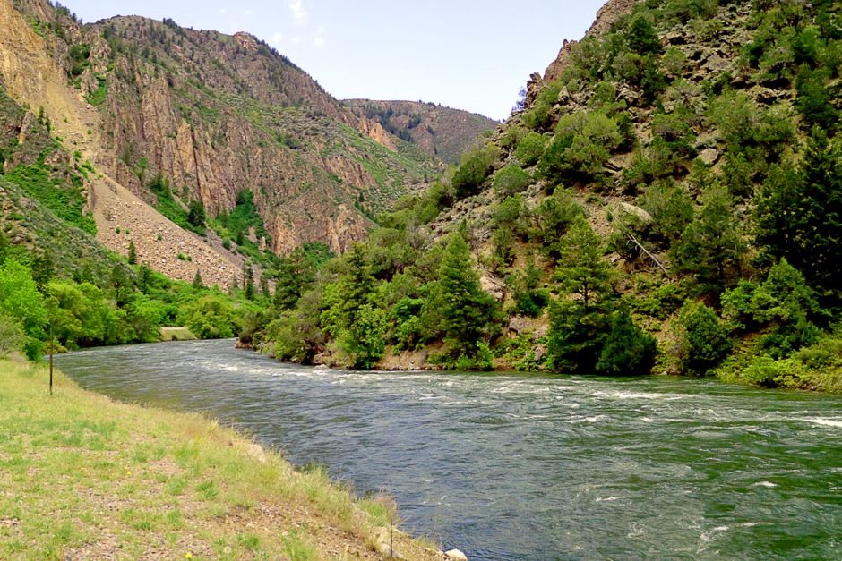
At the bottom we found ourselves next to the proud waterway. Here the canyon floor is wider and the river meanders more gently, upstream from the rapids that slice through the rock just a mile or so away. The turquoise glint in the Gunnison was what mostly caught my eye, when I wasn’t peering back up to the rim high overhead and congratulating myself for having driven down it.
I gave the car a little pep talk and commandeered it back up the steep road to the rim, where we began the south rim drive. There were more people doing this part of the Park but it was manageable: there was always a place to park at each viewpoint and just enough people to make it friendly. Traveling in the off-season is definitely the way to go.
We saw the striations of “painted” rock, funny shapes created by the shadows of the sun or a mischievous passing cloud, and stood atop some heart-stopping drop-offs that the Park Service has decided we can handle. We could see the occasional car puttering along the north rim, and I smiled knowingly to myself whenever I did.
Sunset
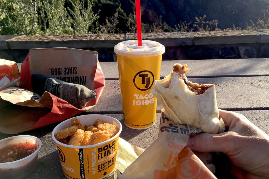
Black Canyon of the Gunnison National Park is fairly small, and unusually for us we are staying at a hotel very nearby. We took advantage of it by leaving the Park to get dinner and then re-entering to watch the sunset.
It’s hard to say when the sunset is actually occurring in a place like Black Canyon; I looked online and found the time of sunset in Montrose, but how does that translate to the high and sheer walls of a canyon? I wanted to get there early just in case, so we found some food at a drive-thru place called Taco John’s and drove to the hopefully aptly-named Sunset Point on the south rim to eat and wait.
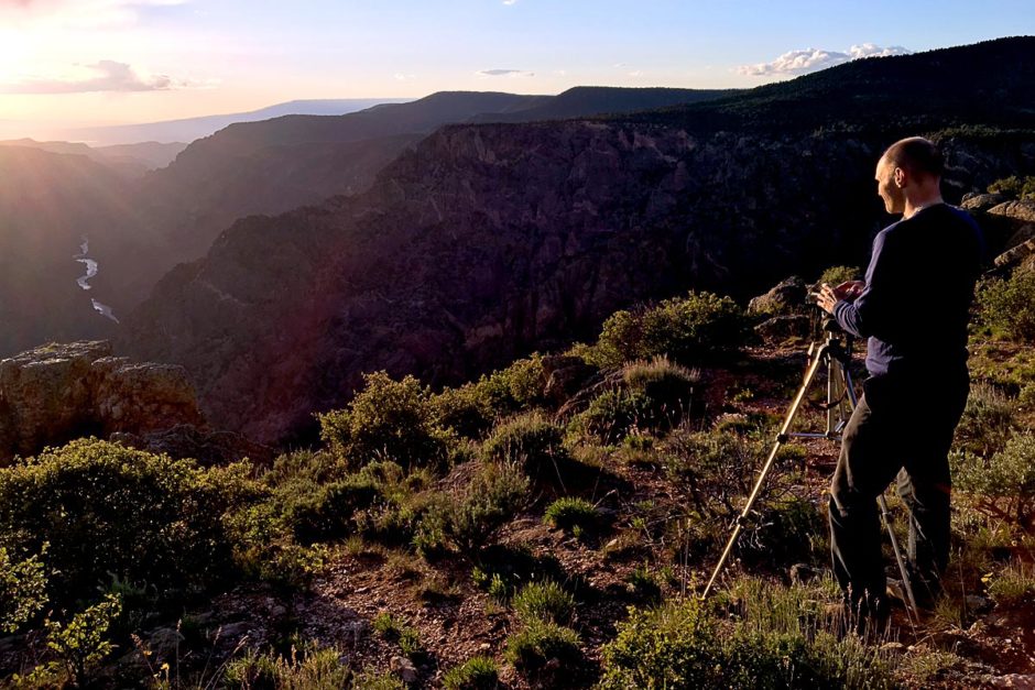
Several other sunset watchers had gathered, including a girl sitting by herself on a large boulder and playing music on her phone. People talked and joked, waiting for the full orange sun to slowly reach the hills beyond the canyon.
It’s called Sunset Point because there is indeed a gap in the canyon and the sun goes down in that gap, highlighting some of the river below and creating levels of purple-grey mountains above it. It seemed to go slowly, even for a sunset, as if the Black Canyon wanted to make sure we all got an enjoyable show.
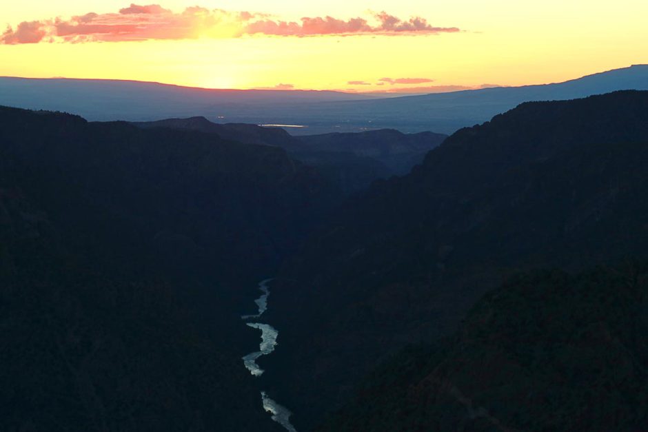
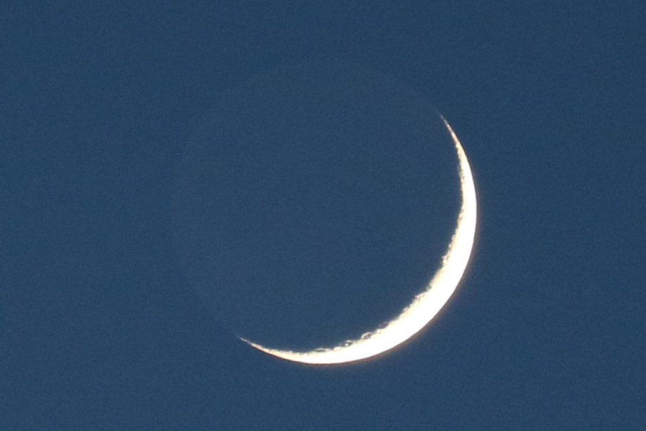
After the sun had finally disappeared and the almost-cloudless sky’s warm colors began to cool, we headed back to the car, marveling at the thin crescent moon that now dominated the sky. Unlike poor Great Sand Dunes, I felt we had seen all of Black Canyon of the Gunnison National Park: both rims, the riverside drive, and now the capper, a perfect sunset.
This is what visiting the Parks is all about. Hiking might have been nice but that’s a whole other experience. Sometimes, the car is enough. And Black Canyon – thanks for being a perfect host.
And the canyon said, “Be healed!”
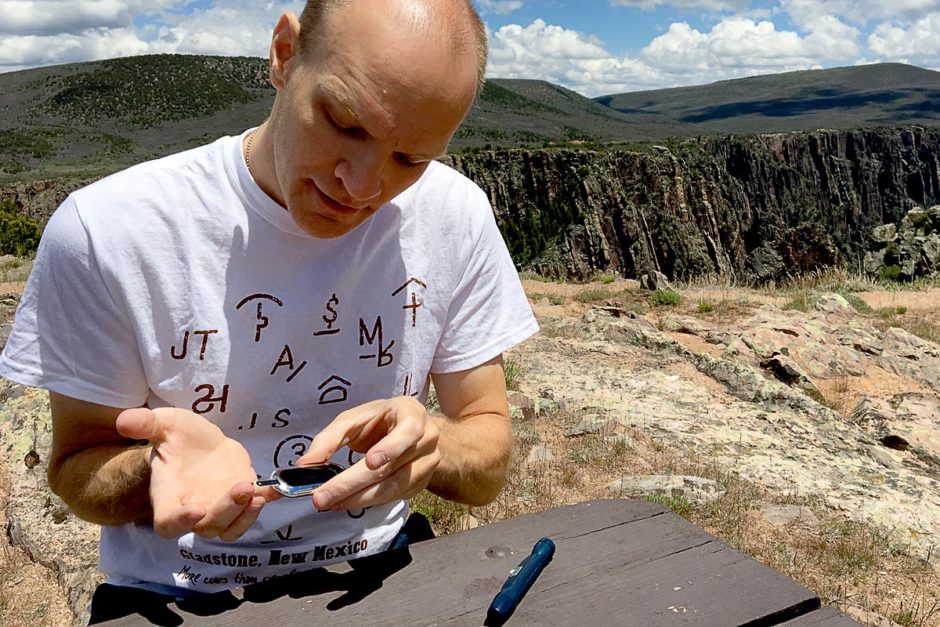
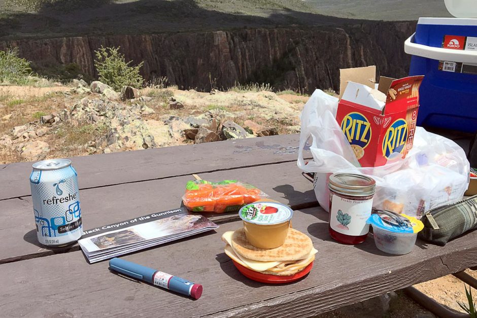
Lunch at the south rim was a picnic at a windy table overlooking the canyon. Homemade sandwiches, apple sauce, carrots, olives, crackers, cookies, and seltzer water. However, this meal was eaten under diabetic duress.
That morning my blood sugar had been 278. I was so surprised by this number, as reported by my One Drop meter, that I dug out my backup OneTouch Ultramini meter from my backpack and checked again: it was 295, basically the same.
So after breakfast and driving down and up East Portal Road, I was anxious about what the reading would now be before the picnic. It was still over 200, but I was by now so pleased with the beauty of my surroundings that I took it in stride. For the picnic, I took less insulin than I normally would have; I was aiming for 200 (instead of 100, my usual) because there would be some short hikes from the car to the viewing platforms right after lunch.
It was a gamble that paid off: a while later I was 138, and a while after that in the motel room I was 137. Good readings, and consistent ones. I credit the Black Canyon.
Thanks for reading. Suggested:
- Share:
- Read: Day 53: Harsh diabetic lessons at Mesa Verde
- Join: Free email newsletter (info and early video access)
- Support: Patreon (much earlier video access and other perks)

Support independent travel content
You can support my work via Patreon. Get early links to new videos, shout-outs in my videos, and other perks for as little as $1/month.
Your support helps me make more videos and bring you travels from interesting and lesser-known places. Join us! See details, perks, and support tiers at patreon.com/t1dwanderer. Thanks!
Want more? Get the free newsletter
Join us! Sign up to my email newsletter to receive updates, behind-the-scenes info,
and early links to my new YouTube videos before everyone else